Three Years Later…and Future Plans

Yup, three years ago, after minimizing to the max, On August 10, we left our little life by the Monterey Peninsula of California, to….just wander.  There was a full moon that first night, which was important to me.  I know this is a silly picture but here is the full moon just a couple nights ago…three years later:

IMG_2886

We certainly were not lacking in wonderful walks or local scenic beauty where we lived…..see below:

IMG_2865

IMG_2867

Walks on the empty beaches of Monterey Bay were our routine.

IMG_2868

The happy rolling habit began in the sand there.

IMG_2473

Big Sur, my favorite place ever (still!) was just a half hour drive.

IMG_2485

I’m not kidding I’ve probably taken a thousand pictures of the Big Sur area.

IMG_2678

And there were lots of wild flowers.  California Poppies in this case….

And yet, I needed to wander, because….oh, just because.

With very little camping and no RVing experience, I didn’t know how it would turn out.  I figured if it wasn’t working, or if at some point it was no longer fun, I’d just settle somewhere.

That is still the plan.

And though everywhere I camp I think about the possibility of staying and living in that area, it seems like when I settle it will be back somewhere near where I came from in California.  That’s home, and the more I travel, the more I know it.

I’ve also found that I love simple living.  No not without comfort or off the grid…but just living simply.  The less ‘stuff’ the better.  I hope that someday I’ll be able to find a tiny home of some sort.  And space for a garden.

But….for now….WOW, have we got plans!

When we leave Michigan in a few days we will trek straight west across Wisconsin, Minnesota, and North Dakota, retracing our steps to Bismarck, then on into Montana to a Casita Rally!  After the rally we will proceed to the west side of Glacier National Park and spend a couple of weeks there.

Next we head south through Idaho and Utah, right down to the White Mountains of Arizona.  Hopefully we will have timed it right to be able to see the fall colors there.  Then we move on to the Prescott National Forest, also in a mountainous area ( read ‘cool’…maybe cold by this time), until it’s safe weather-wise, to head to CLR…Caballo Loco Ranch, south of Tucson.  That will be our winter place again, except when we leave to spend some holiday time with family, yup, in the Monterey area!

I’ve been working on this plan a LOT, for a few weeks now, and I’m excited to get underway!  And yes, we have reservations for every single stop.  For whatever reason, I’ve found that’s the way I like to travel.

These have been 3 amazing years.  For now, this lifestyle suits me and I’m so glad I made the decision to wander!

IMG_5682

Off we go. 🐶😁🐶

Posted in Uncategorized | 18 Comments

Our Last Michigan Stop

Plus, A Close Call and

One More Visit With An Old Friend

We are approaching Iron Mountain, which is a town, not a mountain, by the way.

It has been a rainy, windy day, but not so much as to make driving difficult.  Suddenly, in front of me, from the opposite side of the road, a huge birch tree comes crashing down and falls all the way across the road, and then some!

It all seems to happen so quickly, but what I remember is that a big empty logging truck that was coming from the opposite direction, just made it under the descending tree without being hit.  The car in front of me swerved off the road on the grass beside the road, to get around the length of it, and in shock, I did the same.  I could see that the tree had completely uprooted itself.

I knew within a couple of minutes there was going to be a traffic jam because oncoming traffic had no way to get around the other side, and there was no way to see over the tree….so I was thinking, GO….get out of the way.  And nope, I didn’t get a picture.

My next thought was, if I’d left my last stop 10 seconds sooner, or driven a tiny bit faster, the 3 of us, JR and WS would be flattened on the road.  You never know.

You just never know.

IMG_2889

Here’s a lovely birch tree near my camp, standing.  I hope it remains so.

IMG_2888

Here is a closer view of it.  So beautiful…

******

Having survived the drive, we arrive in Iron Mountain at Summer Breeze Campground.

IMG_2884

We stayed here a day or two on our way into Michigan.  I liked it so much that I reserved some time here as we leave the state, too.  The campground is as nice as the name sounds.

FullSizeRender

Our spot….beside a leaning birch tree.  Yikes.

We have an old friend in the area!  Syd was the manager ‘extraordinaire’ of the community I lived in near Monterey, California for most of 17 years.  He actually managed the place for 23 years and did a remarkable job.  However, he was born and raised near Iron Mountain and when he and his family decided it was time for a change they came back to the area.  That was around 2 years ago.

I get in touch with Syd via text about a week before we arrive here and he plans to come see us.  Joy always loved Syd and when he pulled up at our campsite she about came apart at the seams, as she greeted him.  That was one Joyful Joy!

It was really REALLY good to talk to Syd and find him content with his new home and job and life.  I can see this is his ‘home place’ and he’s happy to be back.  Seeing him peaceful gives me peace too.  He deserves this.

IMG_5690

Our selfie.


Posted in Uncategorized | 16 Comments

The Keweenaw Peninsula

Onward and upward we go, to the Keweenaw Peninsula of the Upper Peninsula of Michigan.  If you look at a map, it’s the ‘finger’ part of the UP that sticks out some 60 miles into Lake Superior.

Actually the area beyond The town of Houghton is misnamed.  Once we cross the bridge there, the rest of the ‘finger’ is actually an island, and we have just crossed the only bridge that leads to it.  Indeed, I later find that the locals call the area ‘Copper Island’.

Mining was the name of the game here beginning in the mid 1800’s.  Oh sure, the Indians knew about the red metal in the earth long before that, and though they found ways to use it, they didn’t exploit Mother Earth.

Some of the oldest exposed rock in the world is here, at 1.1 billion years of age.  Even longer ago than that….about 2.5 billion, give or take… lava flows brought copper and other minerals close to the surface of the earth.

There were literally 100’s of mines here at one time, mostly copper.  The population and wealth expanded with the mining , until the copper became harder to find.

As the mining industry faded, the people and the money faded away as well.  Now you have nature, in all her glory.  You have trees and water and more trees and more water, and don’t forget the wildflowers.  And lighthouses…always old lighthouses.  You have mine tours, and mine museums , and many old mines….holes…where rock hounds find treasures, big and small.

While we are here we stay at Sunset Bay Campground.

IMG_5574

And here’s an example of a sunset here….

IMG_2771

I find myself comparing this place to a Yooper-style Deetjens Big Sur Inn…(if Deetjens were a campground) (and I realize you have to know Deetjens to know what I’m talking about), it’s quaint and funky and eccentric.  It’s got character.  It’s got old hippie vibes that go back long before the hippie era.  The same family has owned this place since 1944.  I feel really comfortable here.

IMG_5564

On Thursday morning early, as I sit with my coffee (in that red chair above), the camp host stops by and tells me there has been a bear in her yard the last 2 nights.  I find that news exciting rather than frightening….however it wouldn’t make me happy if I were camping in a tent.

IMG_5653

The office.

IMG_2830

Morning, before the full sunrise.

IMG_5679

The beach.FullSizeRender

The rocks with part of my shoe for size comparison.  I kept that striped one.

IMG_2834

I was privileged to see a storm while we were there.

IMG_2852

Moody Gitche Gumee.

IMG_5629

The lighthouse at Eagle Harbor, 10-15 miles up the coast from the campground.

IMG_5556

We take a ride up to Copper Harbor, which is as far north as you can go.  My fearless girl.  Gosh, she has trouble walking but she never lets a chance go by, to take a dip.

FullSizeRender

Or to swim.

IMG_5592

It’s a blurry picture but a good example of how Shiloh always try’s to keep his tail out of the water. 😊

IMG_5595

Red rocks of Copper Harbor.

FullSizeRender

A Copper Harbor Beach with some of those billion year old exposed rocks.

What a lovely time it’s been here on the Keweenaw!  I’ve really enjoyed these 5 days.  Yes, winters are brutally cold and snowy. Summers are short.  Nature gets her way a lot, keeping the area remote and absolutely beautiful.  I mean…if you like trees and water, rocks and wildflowers!  I do! I do!

IMG_2788

I like pretty sunsets too!

Posted in Uncategorized | 15 Comments

Wandering Through The UP

Most of the license plates I see in campgrounds here are Michigan plates, but if people are touring their own state, that’s not a bad thing.  It’s a beautiful place to see and there are lots of young families out here.  These are not the kids that will end up as gang members, high school drop outs, or prison inmates.  I mean…for the most part.  There is such a need to get underprivileged kids out into nature.  Nature and wildness are such healers….menders of broken lives, hearts and minds.

Henry David Thoreau said “In wildness is the preservation of the world”.  I might add, and everything in the world, including humans.  Come to think of it, I’m thinking a good number of  our political leaders could use a long hike in the mountains as well.

Anyway…our wanderings take us from Newberry, to Paradise at Tahquamenon Falls State Park, Rivermouth Campground, to a campground called Michihistrigan near Gould City, to Ishpeming, with a stop in Marquette too.  Now we will be moving on to the Keweenaw, a Peninsula of a peninsula.

It has been beautiful, flower filled, and relaxing for the most part.  I’m beginning to plan out some autumn adventures now.

Here are some pictures from over the past week or so:

IMG_5470


IMG_5471

Point Iroquois Light Station.

IMG_5477

Some of the 72 steps inside that I climb!  Almost straight up…which of course, lighthouses are….

FullSizeRender

View from the top.

IMG_5474

Some old fashioned Hollyhocks are planted here.

IMG_5492

Our campsite at Michihistrigan Campground.  Only a few campers here, and lots of open space for the dogs to run….

IMG_5493

And sniff….IMG_5529

And roll…

IMG_5544

And run some more….!

FullSizeRender

IMG_5500

You know travel plans are getting serious when the picnic table looks like this…

IMG_5535

Heading to the Keweenaw now!

Posted in Uncategorized | 5 Comments

Gitche Gumee

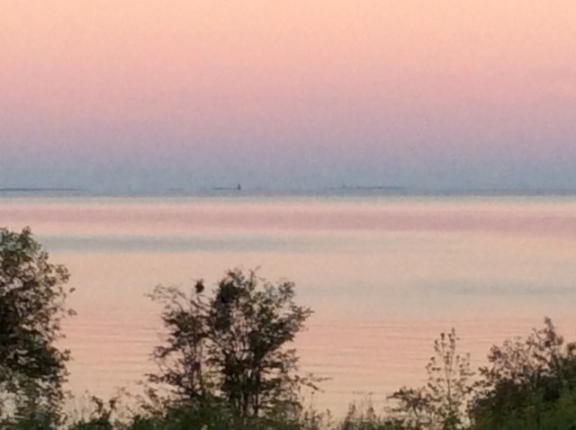
Those are the Ojibwa words for ‘The Shining Big (or Blue) Sea Water’ , which was the original name of Lake Superior, before the French, and then the English, renamed it. Personally, I like Gitche Gumee better.  It’s also been spelled Kitchi gami and Kitchi gummi.  If you are wondering where you heard that name before it may have been in two different places.  First, in the poem “The Song Of Hiawatha” by Henry Wadsworth Longfellow.

“On the shores of Gitchi Gumee, Of the shining big sea water…”

or in the song by Gordon Lightfoot, “The Wreck Of The Edmund Fitzgerald”.

“The legend lives on from the Chippewa on down, Of the big lake they called Gitche Gumee…”

(Chippewa is another name for Ojibwa).

FullSizeRender

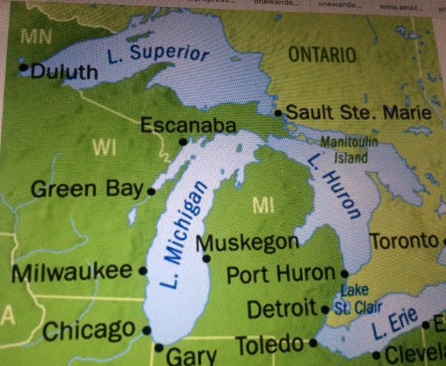
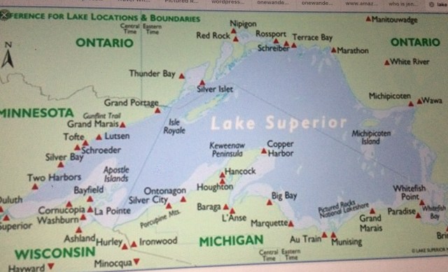
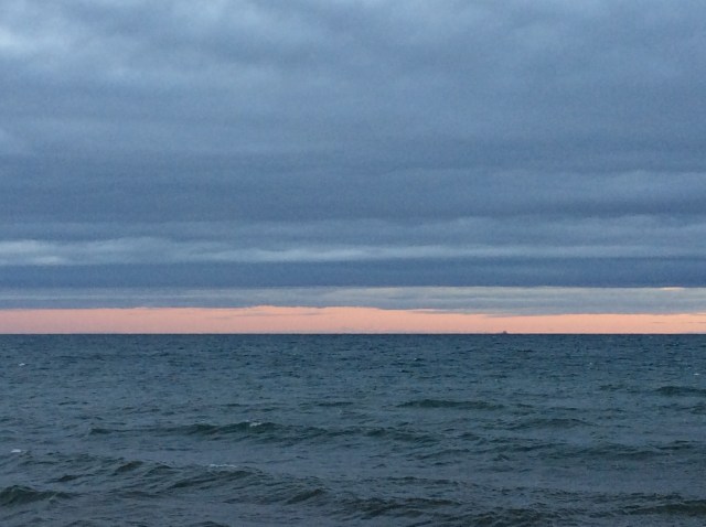
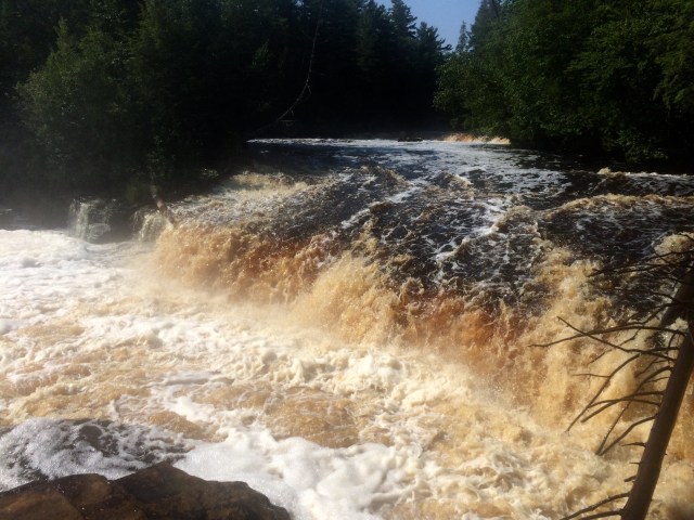
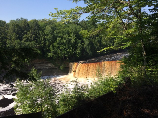
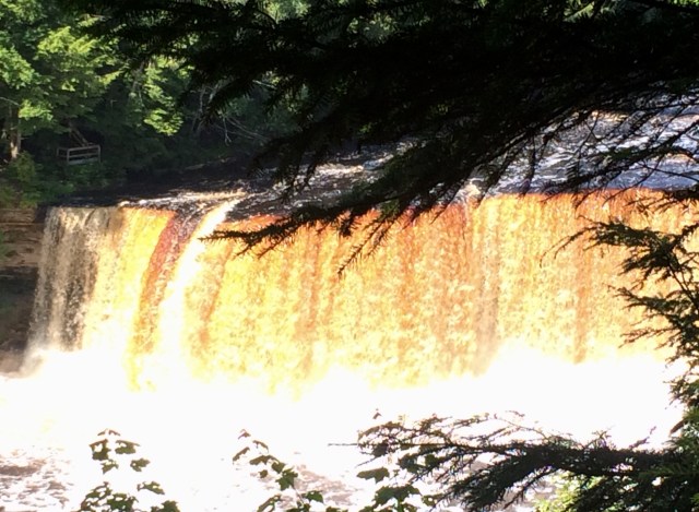
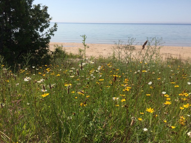
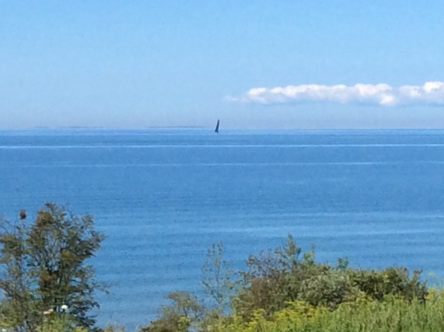
Anyway, this lake in question…Lake Surperior….is the largest of the 5 Great Lakes, and is in fact the largest freshwater lake anywhere.  It covers 31,700 square miles with an average depth of 483 feet and a maximum depth of 1,333 feet.  It is boardered by Michigan, Wisconsin, Minnesota, and Canada.

FullSizeRenderMore detail.

Just to note, of great concern is the fact that since 1979, the surface temperature of Lake Superior has risen a whopping 4.5 degrees F.

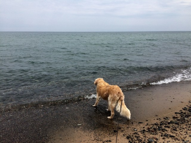
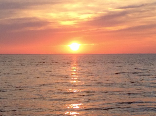
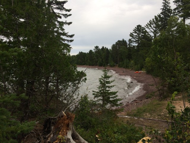
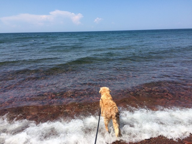
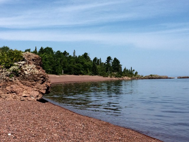
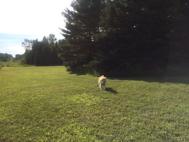
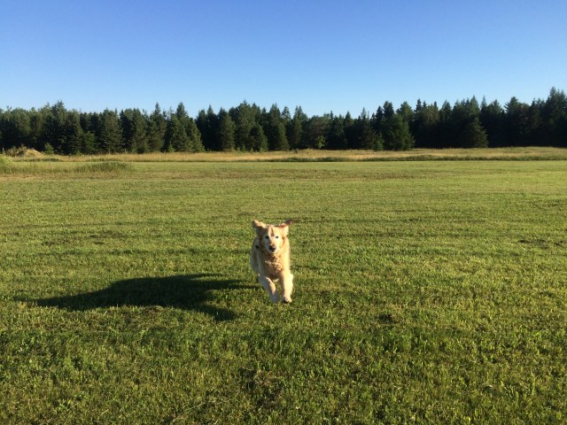
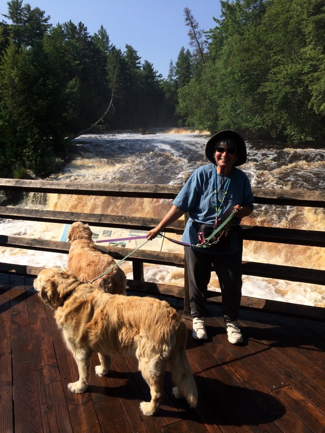
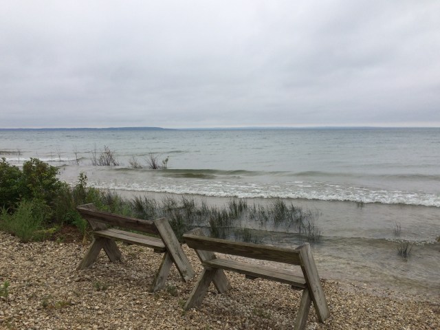
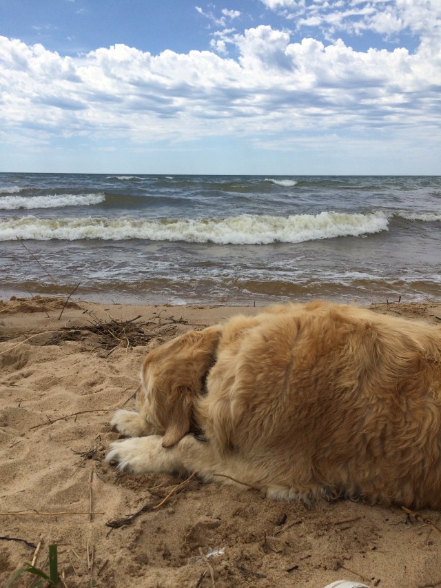
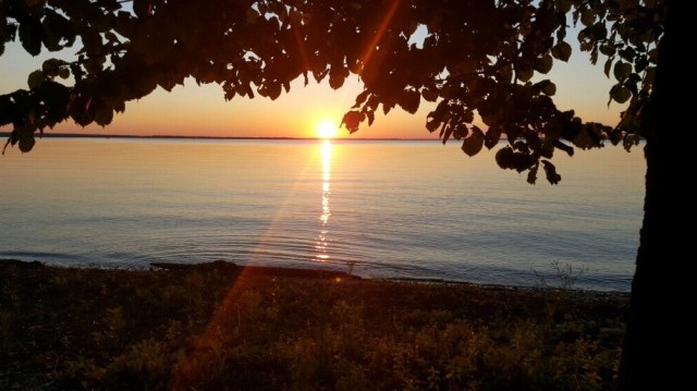
Saturday, July 22, while we are in the tiny town of Grand Marais, Joy and Shiloh get to swim in this big, beautiful lake for the first time ever.

FullSizeRender
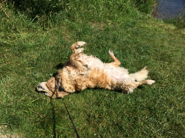
Joy contemplates Gitche Gumee.     But not for long…..

FullSizeRender

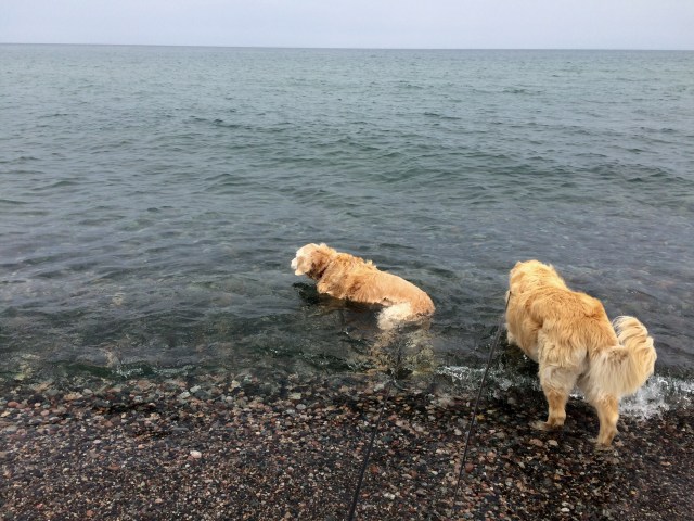
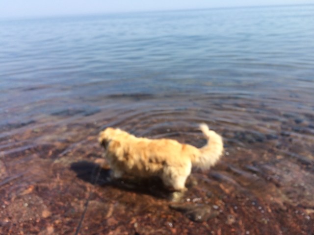
I don’t know, but they seem to understand the significance of such a special place, and they enjoy themselves immensely!  They are in and out of the water repeatedly, and they get silly and bouncy, and Shiloh decides to dig.  They both roll in the sand many times.
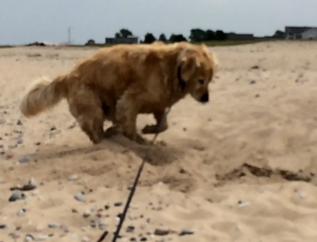
FullSizeRender

FullSizeRenderShiloh digging!

FullSizeRender
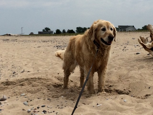
And just being content.

Joy finds a stick that she just can’t give up, so I bring it home with us, along with another one for Shiloh.

FullSizeRender
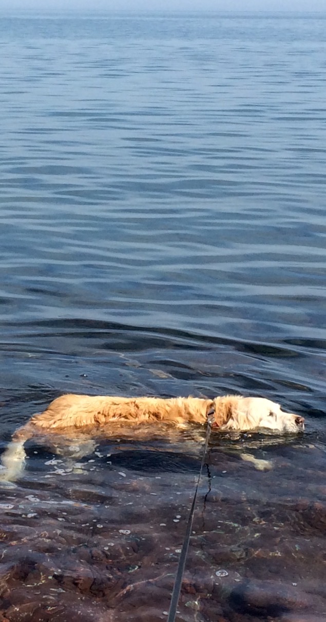
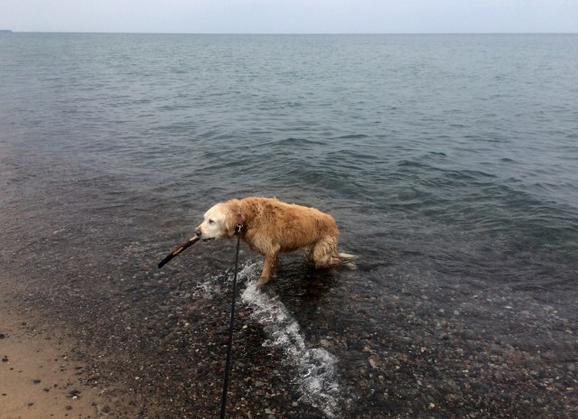
Joy with her stick.  These days she has a hard time coming out of the water. Maybe you can tell in this picture.  I’ve had to go in and help her at times.

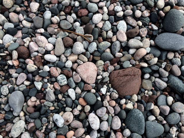
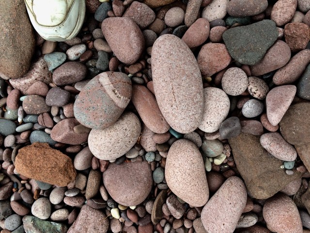
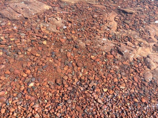
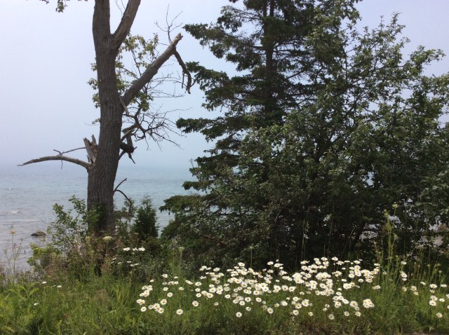
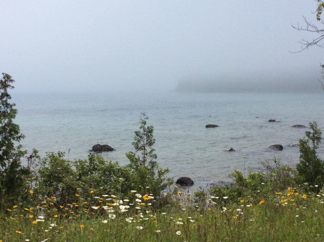
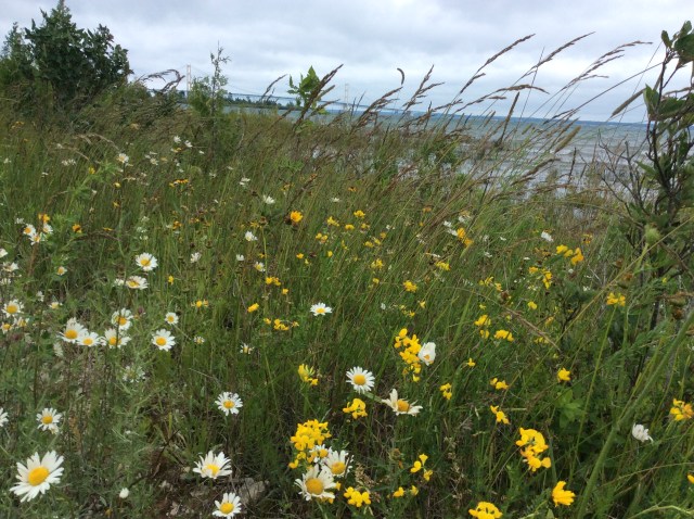
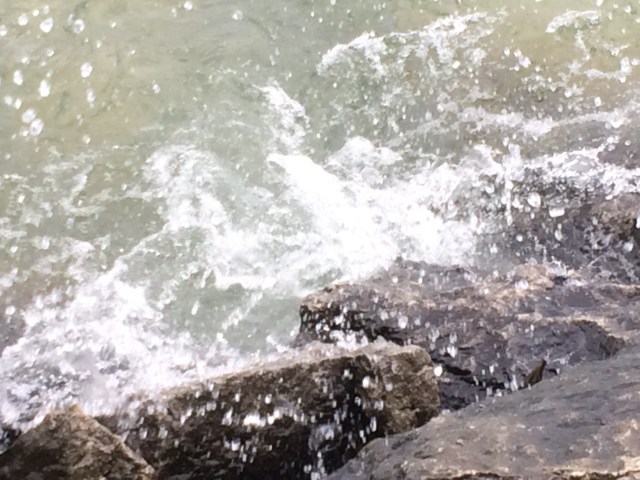
While the dogs are having fun, I’m admiring the rocks as I walk along the shore…and picking up some pretty ones.  (There are no sea shells here, it’s all rounded rocks). No sharp edges.

FullSizeRender

IMG_5397

FullSizeRender
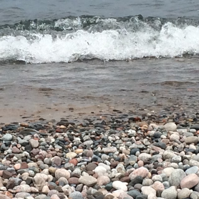
Colors are brighter when they are wet.

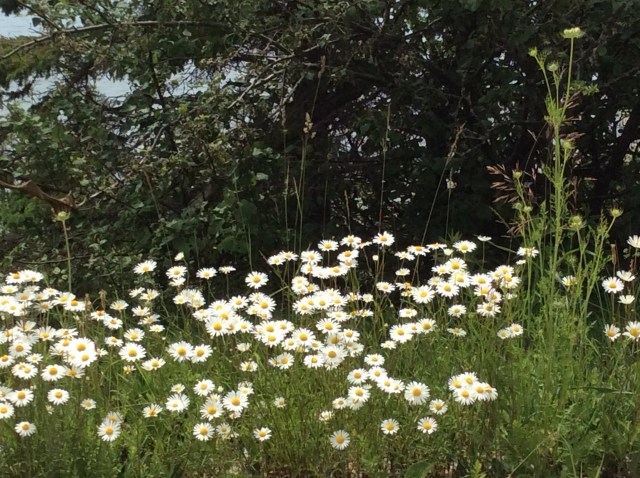
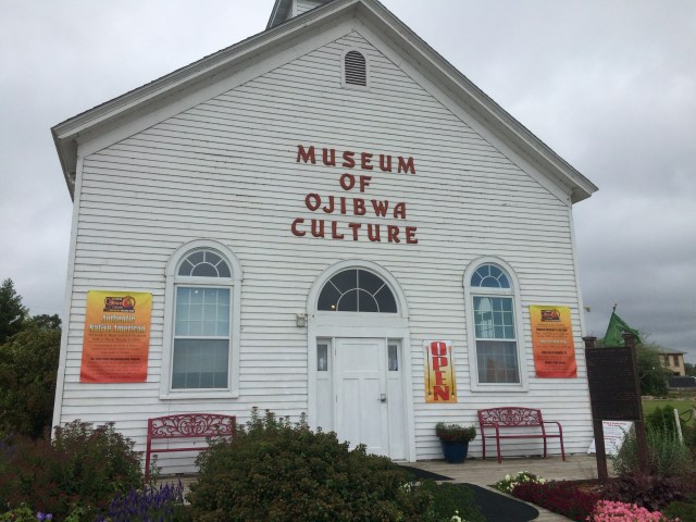
It’s just about impossible for me NOT to pick some up, and, I have just come from Gitche Gumee Museum, home of the agate lady, where I’ve been looking at Lake Superior agates.    You can check her out at http://www.agatelady.com .  The museum has many agates and other rocks, from Gitche Gumee and elsewhere, as well as the history of the Grand Marais area.  And there is a gift shop as well.

FullSizeRender

FullSizeRender

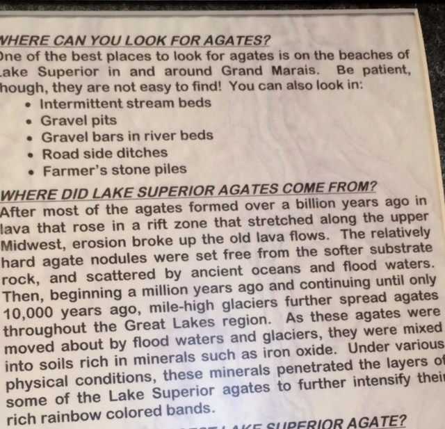
Above is a little info about Lake Superior agates.  Below, are some examples.

IMG_5366

Back to the beach.

FullSizeRender
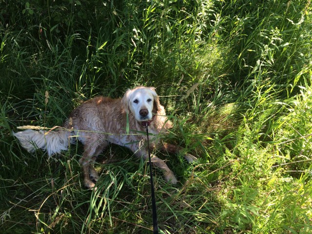
Joy spends time chewing on her hard earned stick.

FullSizeRender
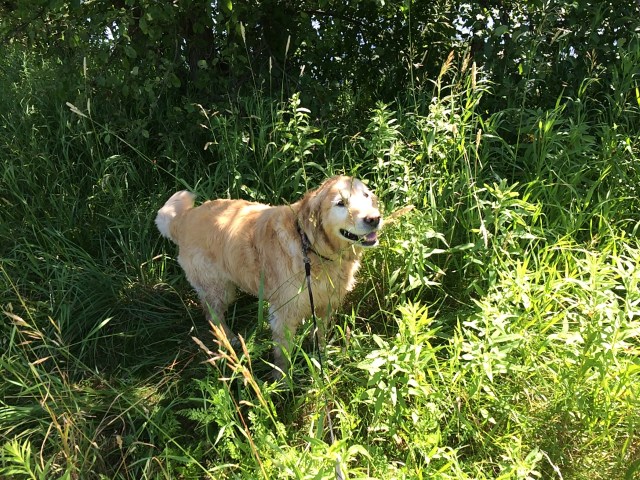
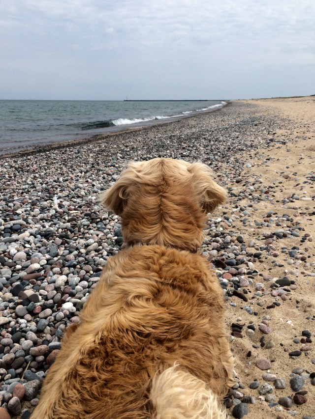
She thinks the view down the shore is just fine.

We are there a good hour or so, and it isn’t until we are leaving that I see a sign that states dogs aren’t allowed on the beach!  Honest!  The sign I saw before said that dogs must be leashed.  Kinda confusing?  No one complained while we were there though, on the contrary, the furry ones got loved on, as usual.

Backtracking………

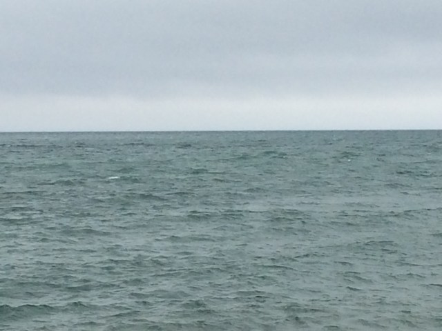
On Thursday, July 20, our attempt to make contact with Gitche Gumee isn’t so much fun.  I’m quite excited as we load up for a trip to Whitefish Point and The Shipwreck Museum.  The sky is a beautiful blue and when we reach our destination the temperature is in the mid 70’s.  That sounds nice, I know, but for my furry old companions, it’s boardering on too hot.

When we arrive I see a beach area with a trail nearby, so we get out, get leashed up, and head that way.  Before 2 minutes pass, the flies attack! They literally cover Joy and Shiloh and the dogs are going crazy, trying to get them off.  These flies don’t scare easily and waving my hands around doesn’t make them leave.  They have to be literally brushed off.  So gross!  We hurry back to the truck and the dogs are upset.  They get a drink, I give treats and say calming things while I turn on the A/C.  After awhile I try again by myself.  I’d really like to explore here a bit, but it will have to be fast.

FullSizeRender
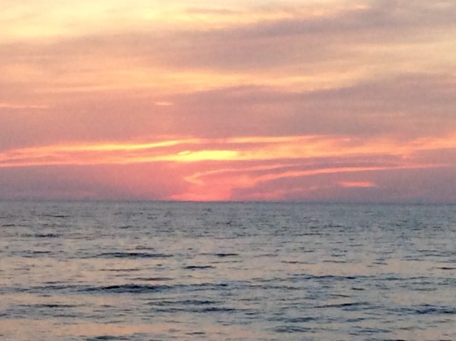
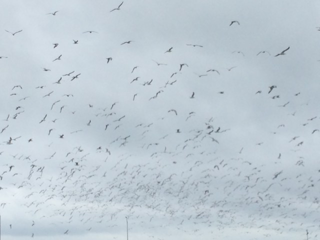
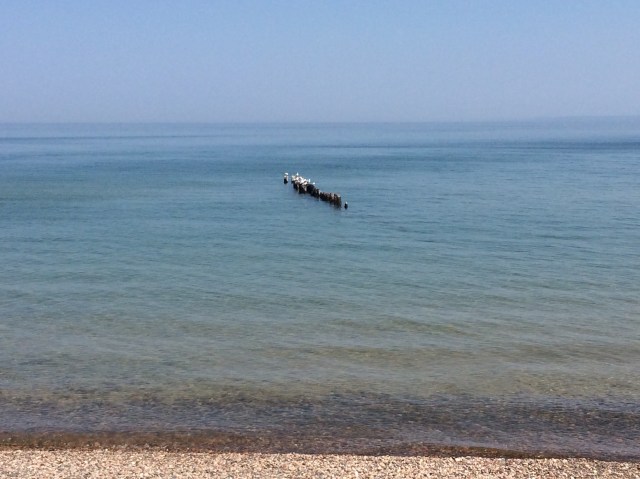
Nice day, minus the flies.  That looks likes the remains of a pier out there, with birds sitting on it.

FullSizeRender
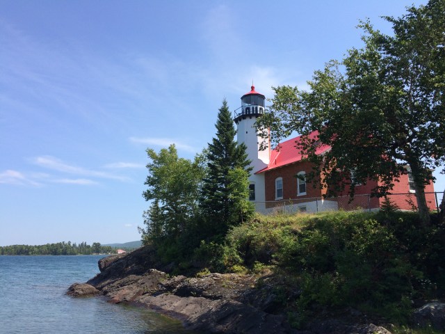
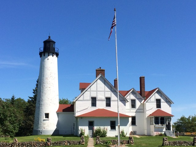
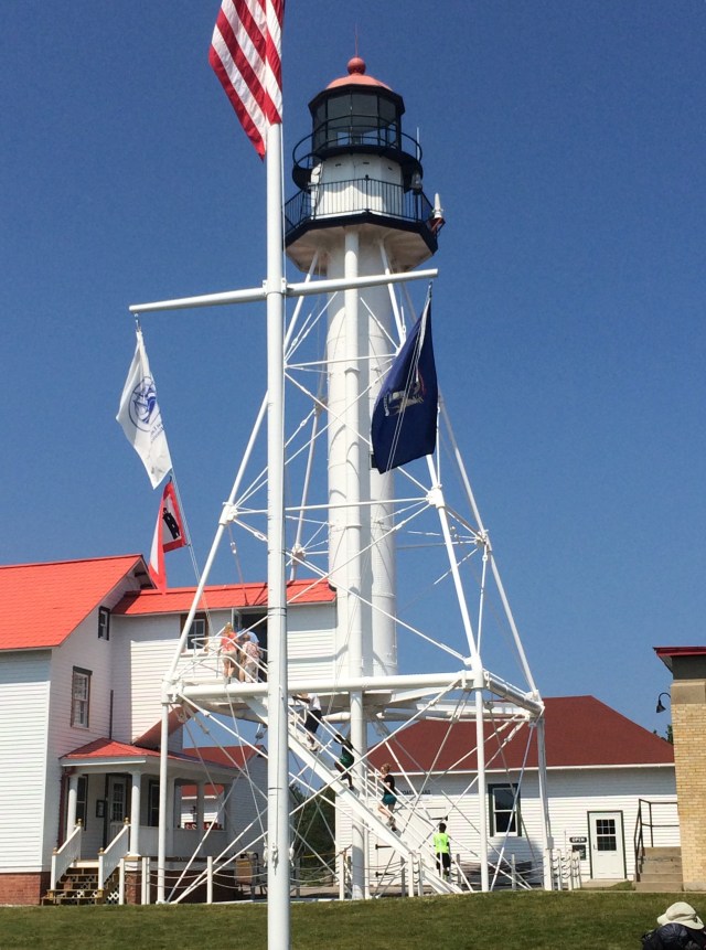
The lighthouse at Whitefish Point.

There is no shade to park in, anywhere, but I turn off the engine and leave the windows open.  I’m concerned that hordes of flies will come inside but that doesn’t seem to be happening.

I take a few pictures and talk to a few people, and find out, low and behold, dogs are allowed in the museum!  They must be leashed and well behaved and we are good on both counts.  Back I go to the truck, swatting at flies all the way.  I unload Joy and Shiloh and we rush to the museum.  I’m brushing flies off of them as we go in the door.  Ugh!

I pay my $13 and find that the museum is contained in various buildings here on the grounds near the lighthouse.  Dogs are allowed in all of them.  However, it’s crowded today, there are lots of people trying to escape the flies.  It’s hard to look at displays and control Joy and Shiloh, even though they are good dogs.  I go through the exhibits, more with my mind on not letting the leashes get wrapped around someone’s legs, than the interesting facts, diagrams, pictures and relics around me.

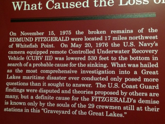
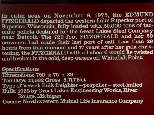
The star of the show is the SS Edmund Fitzgerald, which is the most recent major ship disaster on Lake Superior.  I remember when it happened, as I lived in Michigan at the time and it was in the news for days.  The 729 foot freighter sank 17 miles from Whitefish point in a huge nor’easterner on November 10, 1975.  All 29 members of the crew were lost and no bodies were ever recovered.  The ship lies 550 feet below the water surface, split in half.  The ships bell was recovered and is in the museum.

FullSizeRenderThe bell recovered from the Edmond Fitzgerald.

FullSizeRender

FullSizeRender

FullSizeRenderNow you know the story too.  This stuff gives me chills when I think about it.

They show a movie about the Edmund Fitzgerald in another building and I’d really like to see it.  We hurry over to that building but I find it even more crowded than the main museum.  It’s going to take awhile to get in the door, meanwhile the biting flies are all over Joy and Shiloh again!  (They aren’t as bad on the humans).  We can’t stand here waiting to get in.  Nope, this is terrible, we are leaving.  A very kind lady offers to walk the dogs for me while I watch the movie ( it’s not a very long movie apparently).  I thank her very kindly but explain that the flies are eating them alive while they are outside, walking or not.  We rush back to JR, load up, and turn on the A/C.  Windows are up!  We’re outta here, never having gotten near  the water.

I’m glad our second attempt worked out so much nicer!  Happy dogs, happy mommy!

FullSizeRender

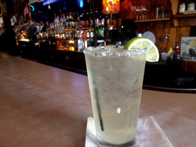
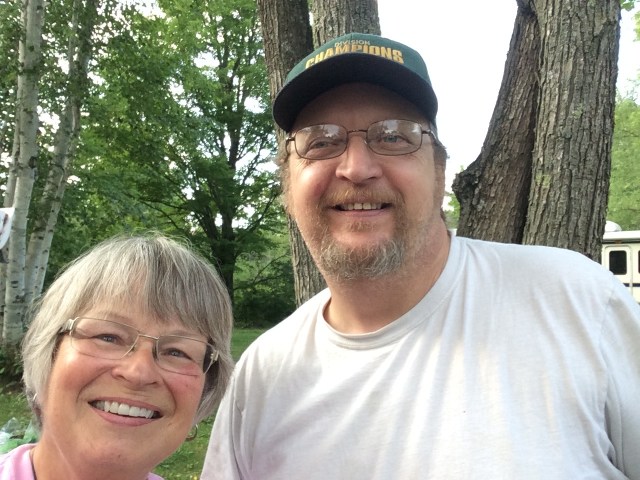
Oh yeah.  I managed to find time to sip on this Margarita too, while we are at Grand Marais.     Here’s to a little more happy!

Posted in Uncategorized | 14 Comments

Tahquamenon Falls…and Trees

(To pronounce that, it sounds kind of like ‘phenomenon’.)

We leave St Ignace and head mostly north, but not too far.  Just to Newberry, where we are back to camping in the woodlands, surrounded by green.

IMG_5261

When I look up…..

IMG_5265

I see this.  Well…except I have the awning up now. 😀

Our first night here we have a big thunder and lightening storm, which I think is beautiful.  The dogs, not so much though.

In the morning the sun is shining and the fresh, clean earth and trees beckon.  We load up into JR and I head northeast.  When I start out I’m not sure what we’ll see today but it turns out to be Tahquamenon Falls….by way of Paridise!

IMG_2662

I’m glad we made it, too!

Not far from Paradise is Tahquamenon State Park, with a river and falls by the same name.  At this point the river is close to reaching its destination…Lake Superior.  It’s grand finale is very colorful!  It was my understanding that the water is brown, but in the falls, it’s beautiful shades of gold!


FullSizeRender

FullSizeRender

Similar in color to Joy and Shiloh.

FullSizeRender

FullSizeRender

I couldn’t stop taking pictures!

FullSizeRender

The color is caused by tannic acid…tannin…from the Cedar swamps drained by the river, along with decaying Hemlocks and Spruce.  The ‘acid’ is very weak however and the river maintains a PH of 7.3 so it’s safe for fish and other wildlife.

There is a 4 mile trail to the upper falls…but there is also a road, so we take it!  The Upper falls is more than 200 feet across and has about a 45 foot drop, making it either the 2nd or 3rd largest falls east of the Mississippi, depending on who you ask.  The largest is Niagara of course.

IMG_5307

IMG_5308

FullSizeRender

There is a stairway of 90 some steps down to the bottom here, but needless to say, we didn’t go.  Joy would never make it….even though she really wanted to go.  They both have been receiving lots of attention and pats and have heard the word ‘beautiful’ directed at them numerous times, so they are all happy and waggy, but I know Joy is going to wear out soon.  In fact on the way back to JR we stop in the shade and rest because I see that she really needs to.  Also, it’s about 76 degrees and humid, and even that is warmer than they like to be.

Something unusual….not only are the trails to the falls at this state park dog friendly, but I noticed a sign telling people to NOT leave dogs in cars, by any means!  I wish more places would understand this important concept.

Now back to trees….

IMG_5310

Maybe we take them for granted because …oh there seem to be so many and they have always been around….but each one is a miracle….

IMG_5312

They live so long and see so much.  They are so….peaceful….

IMG_5311

And maybe they have a prayer……

IMG_5271


Posted in Uncategorized | 24 Comments

Moody Waters and Wild Flowers

And some other things….

This post will be mostly pictures…just pictures of pretty scenes I’ve noticed in and around St Ignace, Michigan.

IMG_2559

Like the blue and green I’m so fond of.  With a freighter , toooo….

Lake scenes really can be moody.  The one above is carefree and light….

FullSizeRender

And this one of the same area but by the shore instead of on the hill, on a stormy day is so somber…sad…sorrowful.

IMG_2582

There are wildflower bouquets by the basket full….

FullSizeRender

At the lake side…..

IMG_2565

At the roadside….

IMG_2584

Everywhere in between.

IMG_2560

Add some fog….

IMG_2563

And a rocky shore…..or….

IMG_2600

Morning stripes of pastels.  And a sailboat.

IMG_5093

Sometimes shades of gray.

IMG_2591

Wind….oops, that picture is crooked!

IMG_5126

Some rain…..

IMG_5094

Waves splashing on the rocky shore.

IMG_2653

Super blue with another sail boat!

IMG_5083

Beautiful boquet!

IMG_5078

Joy thought the flowers were beautiful too!

IMG_5205

Shiloh blends in with the sandy shore as he watches moody Lake Michigan.

IMG_5063

Seagulls!  Jonathan Livingston…is that you?

FullSizeRender

Beautiful morning blues.

IMG_2585

Stand out in a crowd!  Dare to be different!  Bloom where you’re planted!

FullSizeRender

Joy, sleeping it off.

Tomorrow we move again.  I’m unsure (as I often am), about if I’ll have decent internet or cellular connections.  So until next time…take care.

Posted in Uncategorized | 14 Comments

Being A Temporary ‘Yooper’

IMG_2660

Folks in the Upper Peninsula of Michigan call themselves ‘Yoopers’ and they call the folks in the Lower Peninsula ‘Trolls’…. under the bridge…get it?  😊

Popular food up here, at least for the tourists, are Pasties, which consist of some kind of meat, and veggies like carrots, turnips, onions, and potatoes, diced up inside a folded over pie crust.  You can find vegitarian ones too, without meat.  Also you’ve got your standard slabs of fudge, and there is the saltwater taffy ( though the lakes are promoted as salt free, shark free, always fresh, and sometimes frozen. )

All that touristy stuff, and yet the UP is even more laid back than the LP, with no big cities, and even more green and blue, if that be possible.

This peninsula is boardered by Lake Superior on the north, and the St Mary’s River, with Canada across the way.  On the south it’s Lake Michigan and Lake Huron.  The east gives you the continuation of the St Mary’s River which becomes the St Lawrence Seaway.  On the west is Wisconsin.  Since the Mackanac Bridge was opened in 1957, you can see why, especially the old-timers up here, identify with Wisconsin more than Michigan…it was the only land connection for a very long time.

The eastern side of the UP has a strong French influence,and  the west side is more Nordic.  Overall, for me at least, there is still a Native American feeling, but I’m not sure what that means exactly….it’s a feeling.

We have been at this nice little RV Park in St Ignace,

IMG_5120

and this has been my view for the past week.

IMG_2544

IMG_4998

When I passed through here in late May I reserved this site in the ‘front row’ for my return to St Ignace.  I wanted the view, even though I’d need help backing in.  The park is crowded now though, and the sites are fairly narrow.

IMG_5017
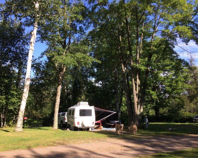
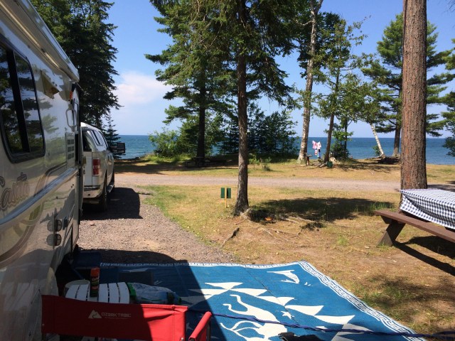
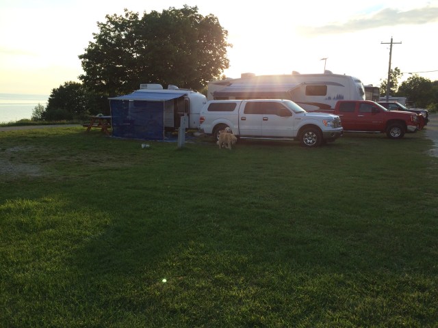
There is no one in the site next to me in this picture, but you can see how close the one on the other side is.

Oh but the view…..

IMG_5016
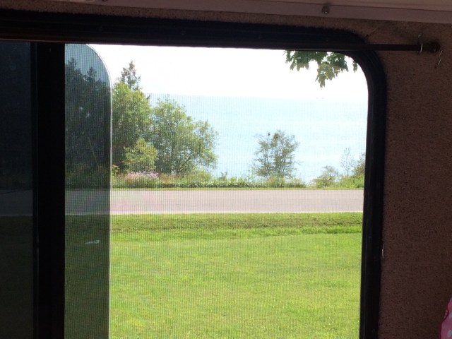
From my back window.

The park is across the road from Lake Michigan but they have lake access, so we can walk down the hill anytime and the dogs can take a little dip.

FullSizeRender

While here we’ve been to the Museum of Ojibwa Culture,

IMG_5085

the Fort de Baudelaire Museum, the Mackinac Straights Photo Gallery,

IMG_5091

the Father Marquette Memorial, along with a slew of souvenir shops.  Also we visit many areas along the Lake Michigan shoreline to view the many moods of the lake, and we take the 50ish mile drive up I-75 to Sault Ste Marie to see the Soo Locks in action.

IMG_5169
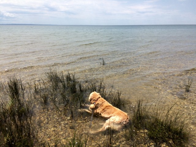
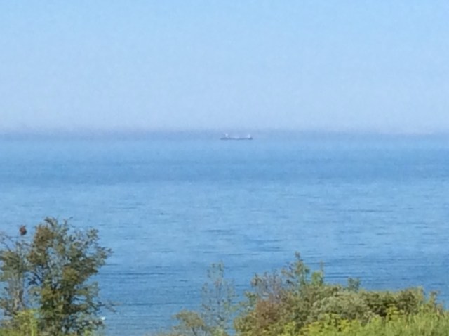
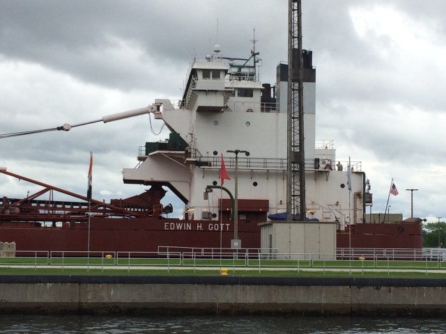
This is the freighter that I saw go through the locks.  It’s 990 feet long!

I find that dogs are not allowed in the viewing area at the locks, so Joy and Shiloh wait for me in JR, in the shade, windows open.  I put 2 quarters in the parking meter, giving me one hour, and in that time I am  able to see a tour boat, a barge, and a huge freighter go from the lower east side of the locks, to the higher west.  Lake Superior is 21 feet higher in elevation than Lake Huron, so they raise and lower the water elevation in the locks.  Three locks are used,and I saw two of them in action at the same time.  I was able to trot back to the dogs and get there before the meter ran out!  That was a lucky break, because often it’s hours between uses, according to recent history print outs.

IMG_5137
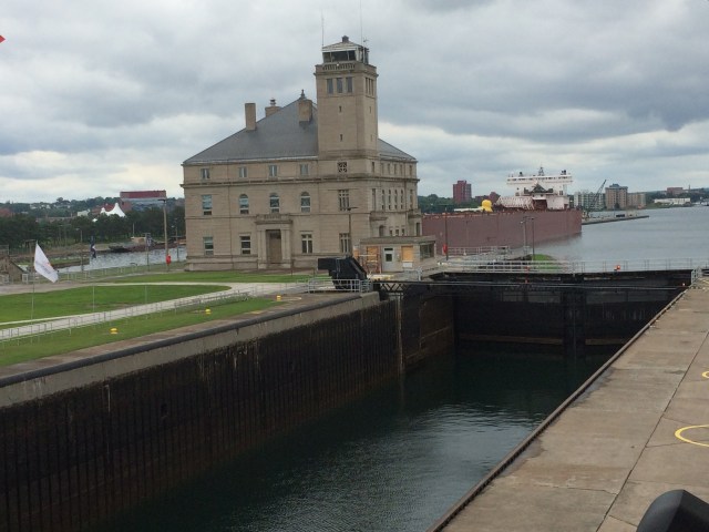
Locks with low water.
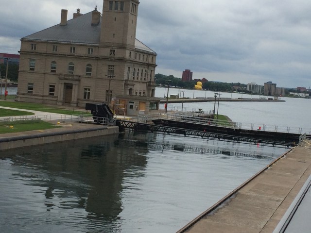
IMG_5163Locks filled.

Freighters facinate me, but so do the Great Lakes, and so does the Mackinac Bridge.  Some bridge facts for you:

Total length of the bridge and approaches…28,195 feet

Height of main towers above the water…552 feet

IMG_4989

Depth of tower piers below water…200 feet

Number of main cables…2

Diameter of main cables…24 1/2 inches

Number of wires in each cable….12,580

FullSizeRender

Total length of cable wires….41,000 miles

Weight of cables, wires and fittings….12,500 tons

Total estimated weight of superstructure….66,000 tons

IMG_4990
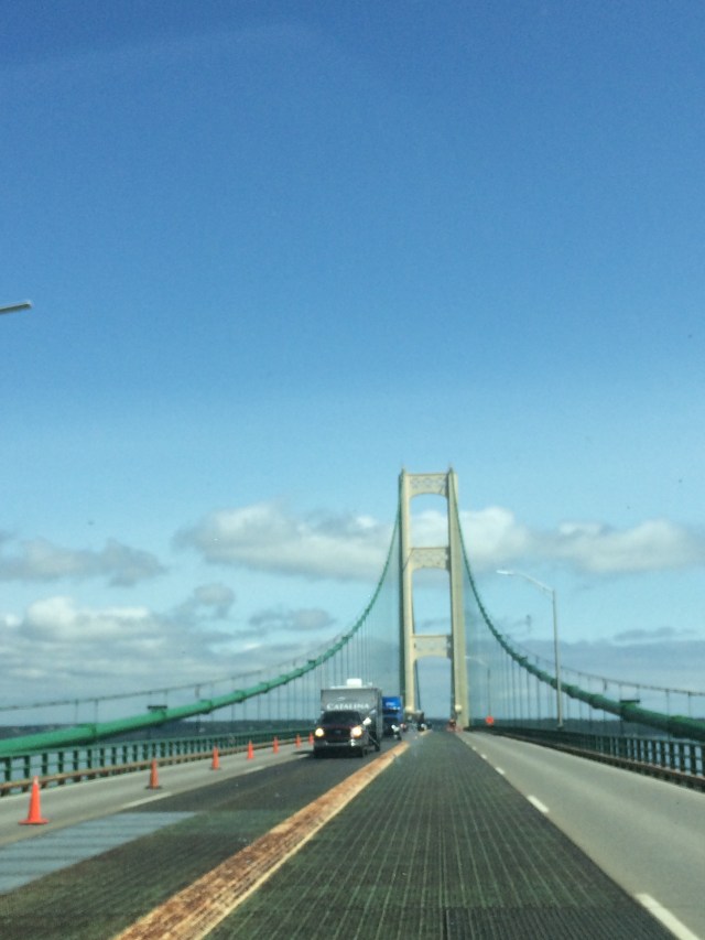
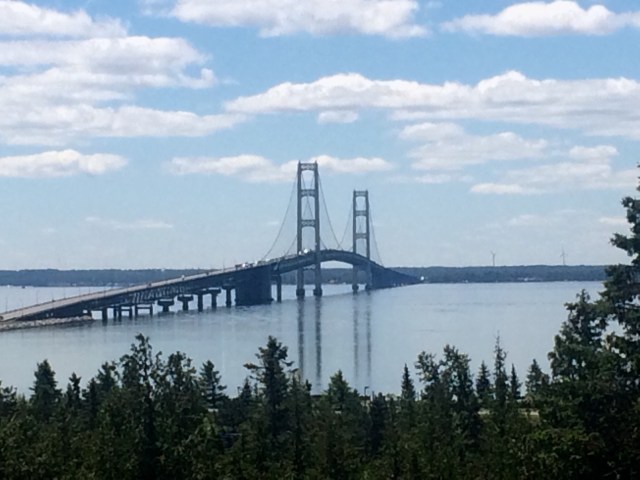
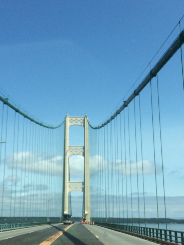
Facing north, from close to the middle of the span.

So, I’ve got more pictures than words right now.  I am going to try to post another blog, with mostly pictures I’ve been taking…coming soon, if I’m successful!


Posted in Uncategorized | 12 Comments

Using The “Allstays” and “Google Maps” Apps

There are a lot of ways to look for places to camp, and so far my favorites are the Allstays and Google Maps apps.  Frankly, I wouldn’t want to be without them.  I paid $10 for Allstays about 3 years ago, and Google Maps was free, but for me they are both priceless in my search for places to camp.

First I make a plan.

So I’m in Arizona and I want to go to Michigan, by way of North Dakota to stop and see friends in both places. I want cool temperatures if they are available, and I want to avoid tornados!  I’d like to see Canyon De Chelly and Mesa Verde.  I’d like to arrive at my friends home in Michigan around Memorial Day.  I’ll have the summer to spend tooling around Michigan, but I want to be back in Montana by September 1 for a Casita Rally.

There are a lot of ‘legs’ to this journey, and I can plan them at separate times.  I’ve found that I like to reserve ahead, when reservations are possible, because I like to know where I’m going, and when.  It puts my mind at ease.  I prefer to travel less than 200 miles a day, and I don’t like to travel every day, even when I’m ‘en route’ somewhere.

So, I go to my Allstays app and start looking for places that are less than 200 miles apart.

IMG_4977

I’m using the KOA where I am now as an example.  You can see that there are other options here.  You can filter what you would like Allstays to show you.

IMG_4976

Here are some of the filters.  You just check them off.

One thing Allstays doesn’t do well and that is mileage, so I go to Google Maps to check distances.

FullSizeRender

You can bet I’ve got paper maps out too…and my notebook and a pen.

At first I’ll be clicking on icons for places to stay, to see if there is anything I like.  I might do this for a day or a week or more, making notes.  I might be looking at various routes, and looking to see what is nearby that I might like to see or visit.

When I get to the point of wanting to start making reservations, it’s because I’ve decided on a route and I have a pretty good idea about the distances involved.

When I click on an icon in Allstays, the name of the place comes up.

IMG_4969

Like this.  Now I know the name of the place, KOA Campground Gaylord.  If I want to know more, I can click on the ‘i’ in the rectangle, and then this happens:

IMG_4970

This box pops up.  This one gives a lot of info, some places don’t give as much.  What you can’t see in this picture continues on to mention this place has free internet, cable tv, it’s pet friendly, they have a pool, and it mentions other amenities.

Next, if I’m still interested, I can usually click on ‘website’ in the green box,

IMG_4971

And I’m there.  In the case of KOA’s, State Parks, National Parks and some other places, I can make a reservation right from that website if I choose to.  Other places require a phone call or email, and that info would be provided either in the box or at the website.

There are usually pictures on the website, but if I want to see more, I can go back to Google Maps, where people post photos and of course there are the photos from above, including the surrounding area.  Like this.  The blue dot is there because I’m taking photos on my tablet, with my phone, and that dot is me.

IMG_4972

I can look closer….

IMG_4973

I like that I’m seeing so many trees.

Even closer.

IMG_4974

Google Maps also has helpful reviews.

FullSizeRender

So, say I couldn’t find a place to stay in the particular area I had hoped to stay in.  Then I’ll need to adjust my travel and go farther, or not quite as far as I planned.  Depending on what’s available this could change things a lot, so I like to make the actual reservation, or at least have some close by options, before moving on to reserve the next stay.  How long I stay in one spot might depend on when something is available at the next place I’m interested in.

It might take me a week or two to get a ‘leg’ of my journey in place.  That’s ok because I have time, and when I’m done, I have a plan, and for me that feels good.

FullSizeRender

Aren’t they a beautiful green?

But what if I change my mind for some reason?

Most places are not set in stone.  Because I’m a VIP KOA member now, I can cancel without any penalty.  Every place has a cancelation policy.  It can range from, if you have the courtesy to notify them 48 hours ahead, or by noon of that day…whatever the policy…there is no penalty, to costing $10….or a full nights stay….to cancel even if you tell them a month ahead.  Checking the cancelation policy before you book is always a good idea!  When I’ve had to cancel at State Parks or COE’s, my money has been refunded.

I do almost all of this planning with my tablet, which receives cellular signals as well as wifi, which is very convenient.

So hope that gives you an idea about how the planning can be done.  I love the planning part myself, and I have the time, so it’s actually fun for me!

And now some doggie pictures!

IMG_4943

This is Big Lake.  It’s not very big really, but that’s what it’s called.  When I was about 8 years old  (Whoa!  60 years ago!) my parents rented a cabin on this lake and we spent a week here.  Now there are no cabins,  and it’s all private property around the  lake except for this one little access spot with a boat launch area.

IMG_4945

And there was some grass to roll in for Joy…

IMG_4956

And that made everybody happy campers.

IMG_4951

Moving on tomorrow, across Big Mac, back to the UP!

Posted in Uncategorized | 17 Comments

Did You Ever Hear Of Onaway, Michigan?

July 5, 2017

Tonight (Wednesday) finds us in Gaylord, MI, lounging in Wandering Spirit under the AC, me with a margarita, binging on NCIS thanks to a USA channel marathon, and a cable hook up at the Gaylord KOA park.

We arrive in Gaylord after two days in Onaway (July 3 & 4), with none other than Mary, my dear friend from California….the one who kindly shares her home with me when we occasionally return to the area we lived in before we began this journey.

IMG_4683

Mary lived the first part of her life in Onaway and has friends and family there….a town of about 900 souls about 45 miles southeast of our last camp at ‘the Tip Of The Mitt’.  Mary was there for a reunion , and we knew I would be in the area too, so of course we had to get together!

As it turns out, Onaway has a very popular 4th of July parade, and usually about 10,000 people converge on the tiny town!  This year Joy, Shiloh and myself were 3 of those people, as well as Mary, who hadn’t been there in about 5 years.

We got to town early so we could set up our lawn chairs in an area with shade and grass ( remember, for me, it’s all about the dogs).  Mary’s son was there too, along with his kids.

People line the street far beyond where I can see them….

FullSizeRender

I have a few parade pictures……

FullSizeRender

IMG_4887

IMG_4892

But I thought it was really interesting how Joy and Shiloh turned into therapy dogs for young and old alike…..

IMG_4867

FullSizeRender

IMG_4882

IMG_4873

IMG_4896

Onaway has a nice park where we took a walk….

IMG_4861

There were lots of pretty wildflowers there.

IMG_4863

And quite a few interesting sculptures done by a local man.  Tom Moran.

Then there is Onaway State Park on Black Lake.  Nice, simple, and not too busy on the holiday week end.

2383-MMS-1499346805000-attachment1-20170705_091429

Mary, Joy and Shiloh with Black Lake in the background.  It’s not black.

2389-MMS-1499346883000-attachment1-20170704_211916

Mary took this one!  Sun about to set.

All too soon our time with Mary is over, and we make the short drive to Gaylord.

IMG_4914
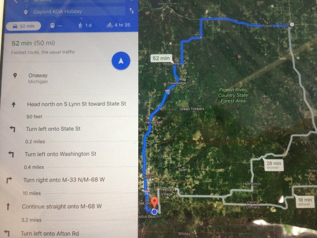
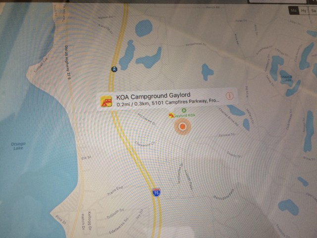
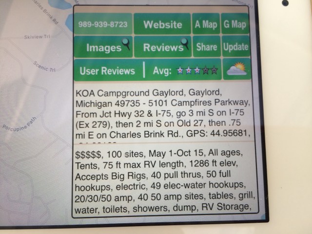
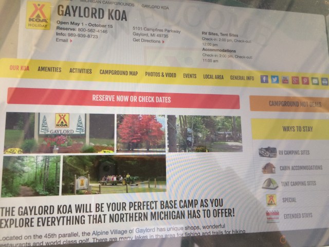
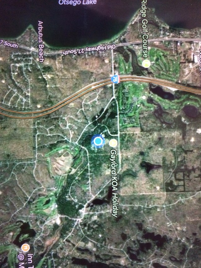
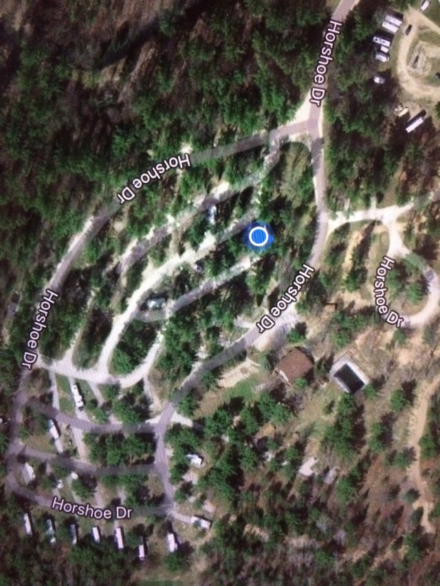
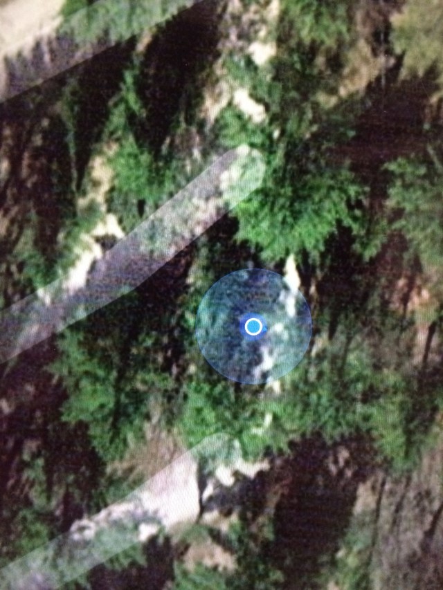
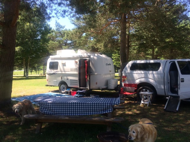
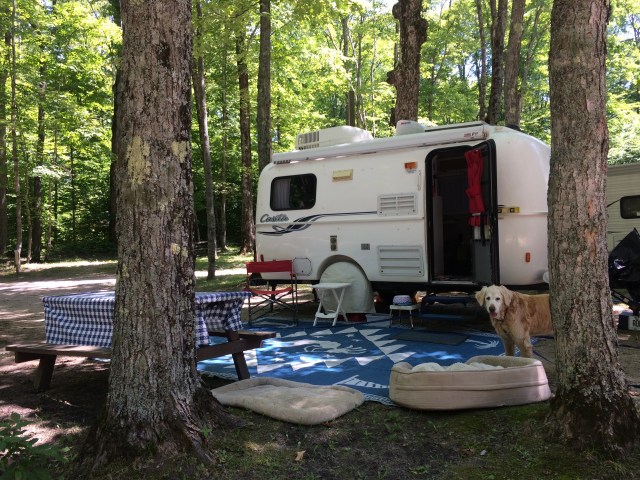
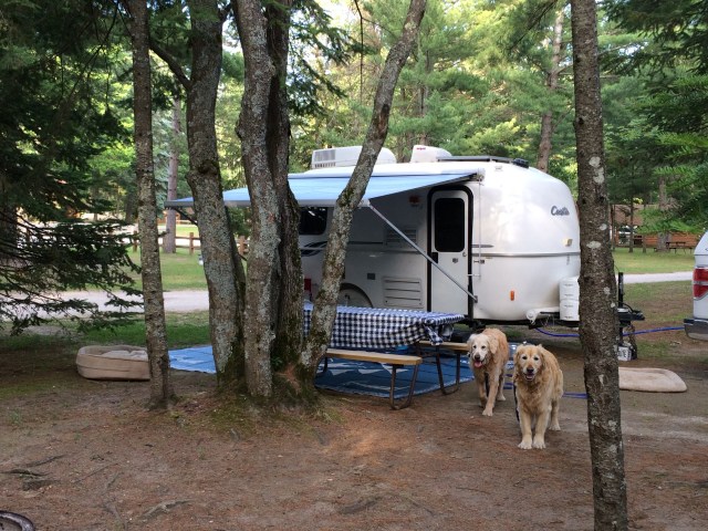
Our campsite at the very nice KOA in Gaylord.  You can’t tell by this picture but this is a huge campsite.

But I have one more meet up!  Marie and Ray, my friends from Tawas, come over to have one last visit.  We have a sweet time, but then…..

IMG_4910

It’s time for them to go…..

That was hard.

But we stay in close contact….

Miss You…Marie…Mary.

Posted in Uncategorized | 6 Comments